Continuing the Destination Leander plan conversation, we’re breaking down the “Leander Tomorrow” section. It will answer the question, “What’s the vision for the future of Leander?” and we’ll break down the vision and goals for future land use.
Destination Leander is a policy document created to help guide Leander’s development. By providing a chapter on the future of Leander, public investments can make more informed decisions that will result in an improvement in Leander’s quality of life.
Vision
The vision for Leander is “a future where the city will continue to grow and prosper in a way that promotes a high quality of life, builds an identity through a diversity of experiences and destinations and ensures that all Leander residents have access to a variety of housing, transportation, and employment opportunities.”
Goals
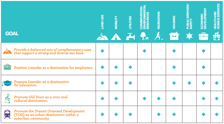
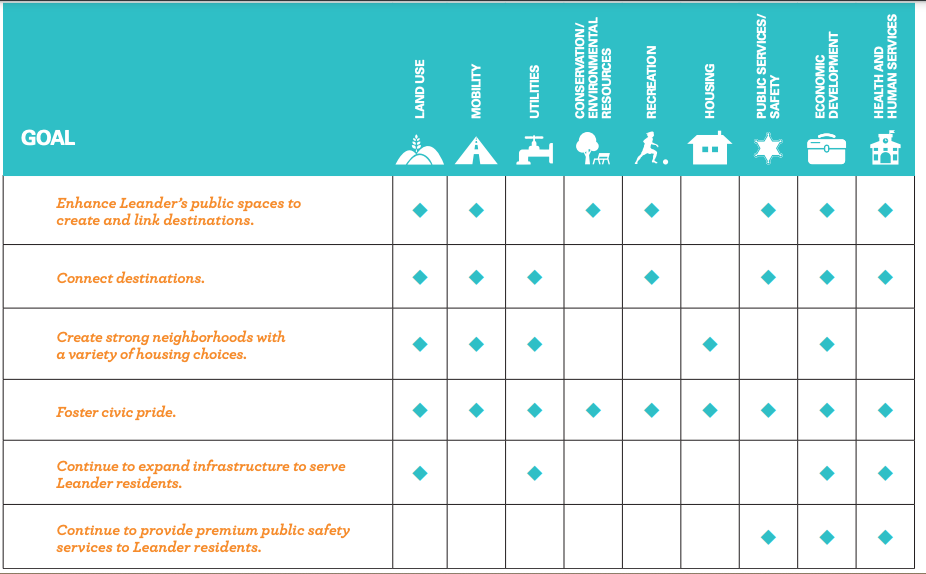
The city has goals for land use, mobility, utilities, conservation/environmental resources, recreation, housing, public services/safety, economic development, and health and human services. Below you can see the charts for the goals they have for each other in those sections.
Land Use
We’ll break down the Future Use Plan Map, as seen below.
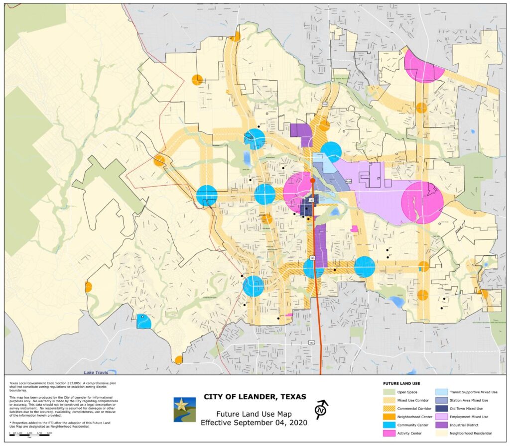
There are 12 land use categories. Each category is drawn to show prominent land use and character development in connection with the class. The description of each type is parallel with the ideas and vision the community has for future growth.
The majority of the map is covered in a light beige yellow, which stands for mixed-use. The next popular color is hot pink, which signifies an activity center. Blue is a pop of color representing community centers. The light purple shape is for mixed employment use.
Natural Resources
Open Space land uses are intended for parks and recreational facilities. To minimize the impacts to the land, water, and air from site development and stormwater management, the term Low Impact Development (LID) has been created. LID practices have saved 25-30 percent over conventional development. These practices will also prevent stormwater pollution, improve aquifer recharge, and provide community amenities, which increases property value.
Some LID practices:
- Protection of existing vegetation
- Minimization of disturbed and impervious area
- Management stormwater close to the source
- Disconnection of impervious areas
- Consolidation and connection of open space
These techniques will be implemented in the map below. The methods will improve the quality of runoff, reducing peak flow, and maintaining groundwater recharge. Stormwater control like bioswales, rain gardens, pocket wetlands, pervious pavement, infiltration devices, rain barrels, and cisterns will also help reduce non-point source pollution and preserve the health of the Edwards Aquifer.
In our next blog, we’ll cover what will be included in neighborhood residentials like centers, restaurants, commercial, and more. Stay tuned!